
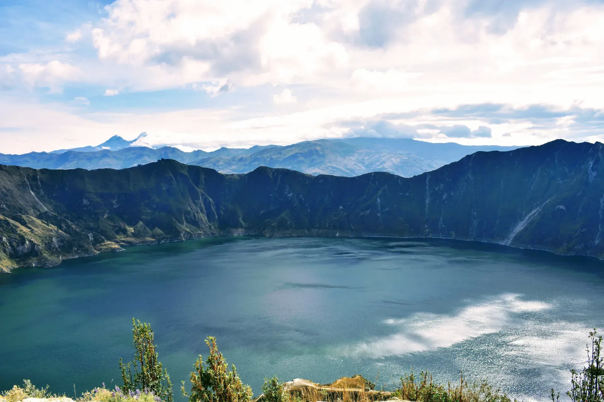
Quilotoa Lagoon fills a three-kilometer-wide volcanic caldera in the westernmost Andes of Ecuador. The 250-meter-deep crater lake shifts between emerald-green and turquoise depending on the sunlight, drawing hikers to its 3,914-meter-high rim.
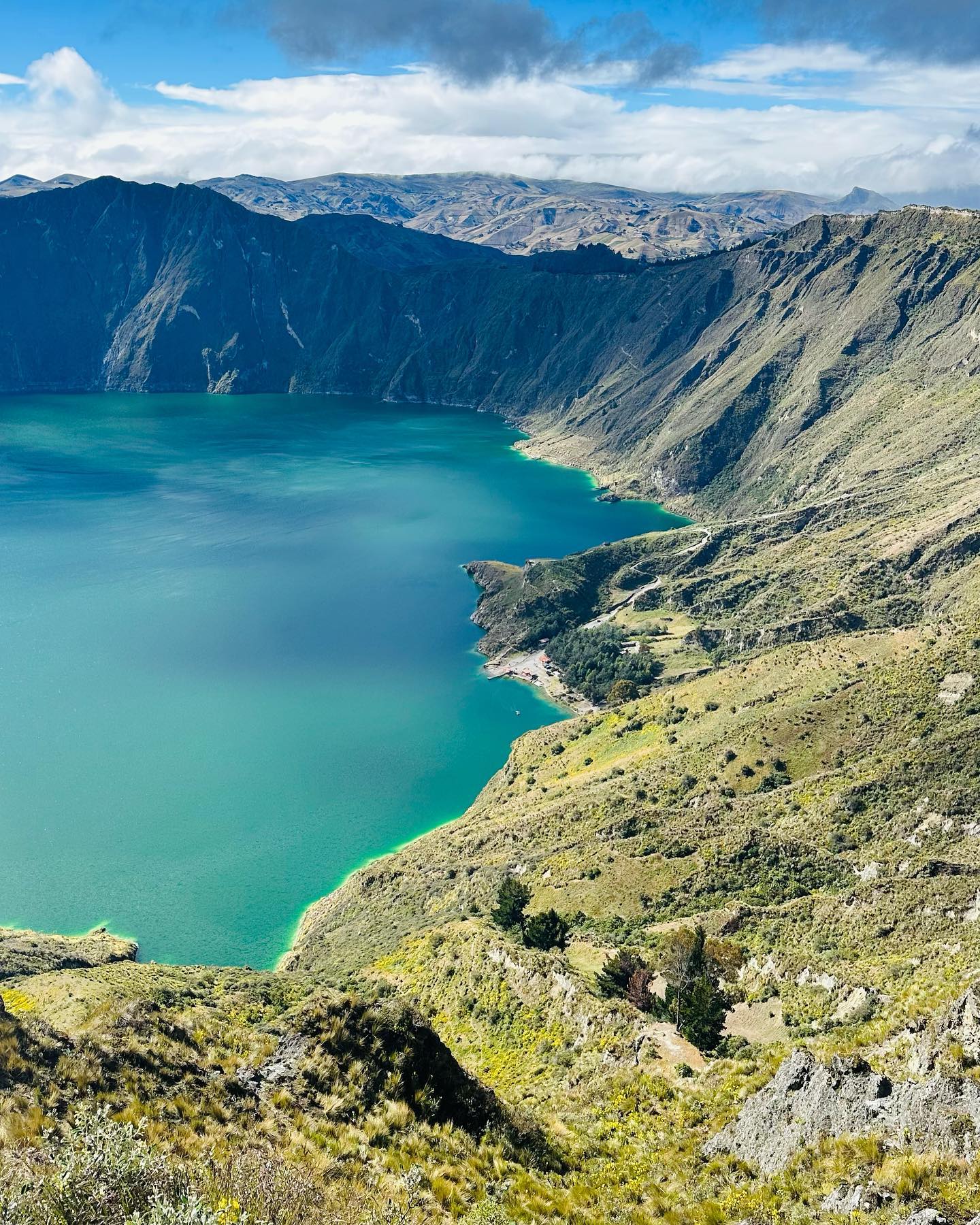
Three kilometers of mineral-heavy water fill the collapsed crater of the westernmost volcano in the Ecuadorian Andes. Quilotoa Lagoon sits at an elevation of 3,914 meters in the Cotopaxi Province, holding a lake that reaches depths of 250 meters. Sunlight dictates the exact shade of the surface. Morning light striking the dissolved volcanic minerals turns the water a bright turquoise. Heavy afternoon clouds shift the lake to a dark, opaque green.
Hikers trace the 10-kilometer circumference of the rim or descend the steep 1.4-kilometer trail down to the shoreline. The descent takes 30 to 45 minutes through loose, sandy volcanic soil. Wind whips across the exposed ridges, dropping temperatures fast. Altitude sickness hits unprepared climbers quickly at nearly 4,000 meters above sea level. The grueling 90-minute hike back up forces many visitors to hire mules from local guides for $10.
The surrounding high-altitude páramo ecosystem falls under the protection of the Reserva Ecológica Los Illinizas. Indigenous Kichwa-speaking communities manage the immediate land, charging a $2.00 entry fee at the village gate to cover parking and restrooms. Muddy trails and heavy cloud cover ruin visibility outside the dry June-to-September window. Visitors arriving in July find clear skies and sharp views of the distant snow-capped Cotopaxi and Illiniza peaks.
Reaching the crater requires navigating winding Andean roads. Buses depart from the Latacunga Terminal, traveling 63 kilometers to Zumbahua before covering the final 14 kilometers to the Quilotoa hamlet. The two-hour ride costs $2.00 and passes the Toachi River Canyon, where a roadside lookout reveals a deep, dramatic gorge cutting through the volcanic landscape. Private transfers from Quito cover 178 kilometers in three hours, dropping travelers directly at the crater rim.
Magmatic processes beneath the western Andes began shaping the Quilotoa volcano at least 266,000 years ago. The mountain grew steadily over millennia, dominated by dacite lava flows and uniform geological conditions. A 14,000-year period of complete dormancy followed, allowing glaciers and high-altitude vegetation to cover the slopes. The silence ended violently in the year 1280.
A catastrophic VEI-6 Plinian eruption tore the mountain apart. The massive explosion collapsed the volcano's dome, instantly forming the three-kilometer-wide caldera seen today. Pyroclastic flows and lahars raced down the Andean slopes, traveling 200 kilometers west until they crashed into the Pacific Ocean. Ash from the blast blanketed the northern Andes, altering the regional climate and burying surrounding ecosystems under meters of volcanic debris.
A subsequent phreatomagmatic phase proved that water had already begun pooling in the newly formed crater. Over the next eight centuries, rain and snowmelt filled the basin, creating a lake 250 meters deep. The volcano never erupted again, but it never fully went to sleep. Fumaroles continue to vent carbon dioxide and hydrogen sulfide on the lake floor. Hot springs bubble constantly along the eastern shoreline, releasing a sharp sulfur smell into the cold mountain air.
Modern infrastructure arrived slowly to the remote Pujilí Canton. For decades, only narrow dirt paths connected the indigenous settlements. The community eventually built an asphalted road connecting the hamlet to Zumbahua, 14 kilometers to the south, allowing daily buses from Latacunga to reach the crater rim. This connection transformed the local economy from subsistence farming to community-based tourism.
In 2014, the local Kichwa population constructed the Shalalá Viewpoint to capitalize on the growing number of hikers. This transparent, glass-bottomed structure extends over the crater edge at 3,900 meters above sea level. Standing on the see-through platform gives visitors an unobstructed view straight down the basalt and ash cliffs to the water 364 meters below. The Ministry of Tourism later recognized the structure for its sustainable architectural design, blending modern engineering with the rugged volcanic landscape.
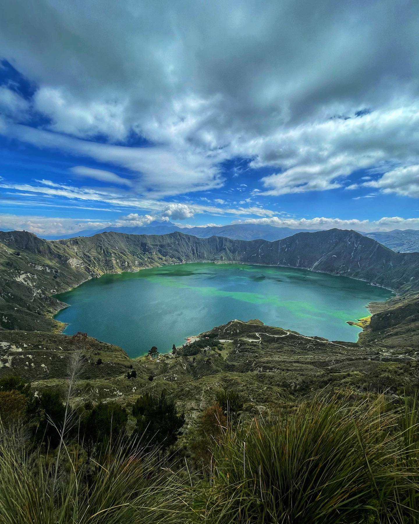
Sheer cliffs of compacted ash and basalt drop 364 meters from the highest point of the crater rim to the surface of the lake. The caldera measures exactly three kilometers across in diameter, creating a massive bowl that traps harsh Andean winds. At the bottom, the lake holds highly alkaline water saturated with volcanic minerals. These dissolved minerals scatter sunlight, producing the signature shift between deep green and bright turquoise.
The lake floor hides an active hydrothermal system. Fumaroles discharge volcanic gases through the mud 250 meters below the surface. On the eastern edge of the water, thermal springs break through the sand. The water here bubbles at temperatures significantly warmer than the freezing lake, filling the immediate area with the distinct scent of sulfur. Swimming remains strictly prohibited due to these toxic minerals, freezing temperatures, and sudden depth drops near the shore.
Volcanic sand covers the 1.4-kilometer trail winding down the interior wall. The soil lacks cohesion, making the descent slippery and prone to minor rockfalls. Hikers wear sturdy boots with heavy traction to navigate the steep, uneven terrain. At the bottom, visitors rent kayaks to paddle across the cold, mineral-rich water. Sitting in a kayak in the center of the lake provides a stark perspective of the towering crater walls rising hundreds of meters in every direction.
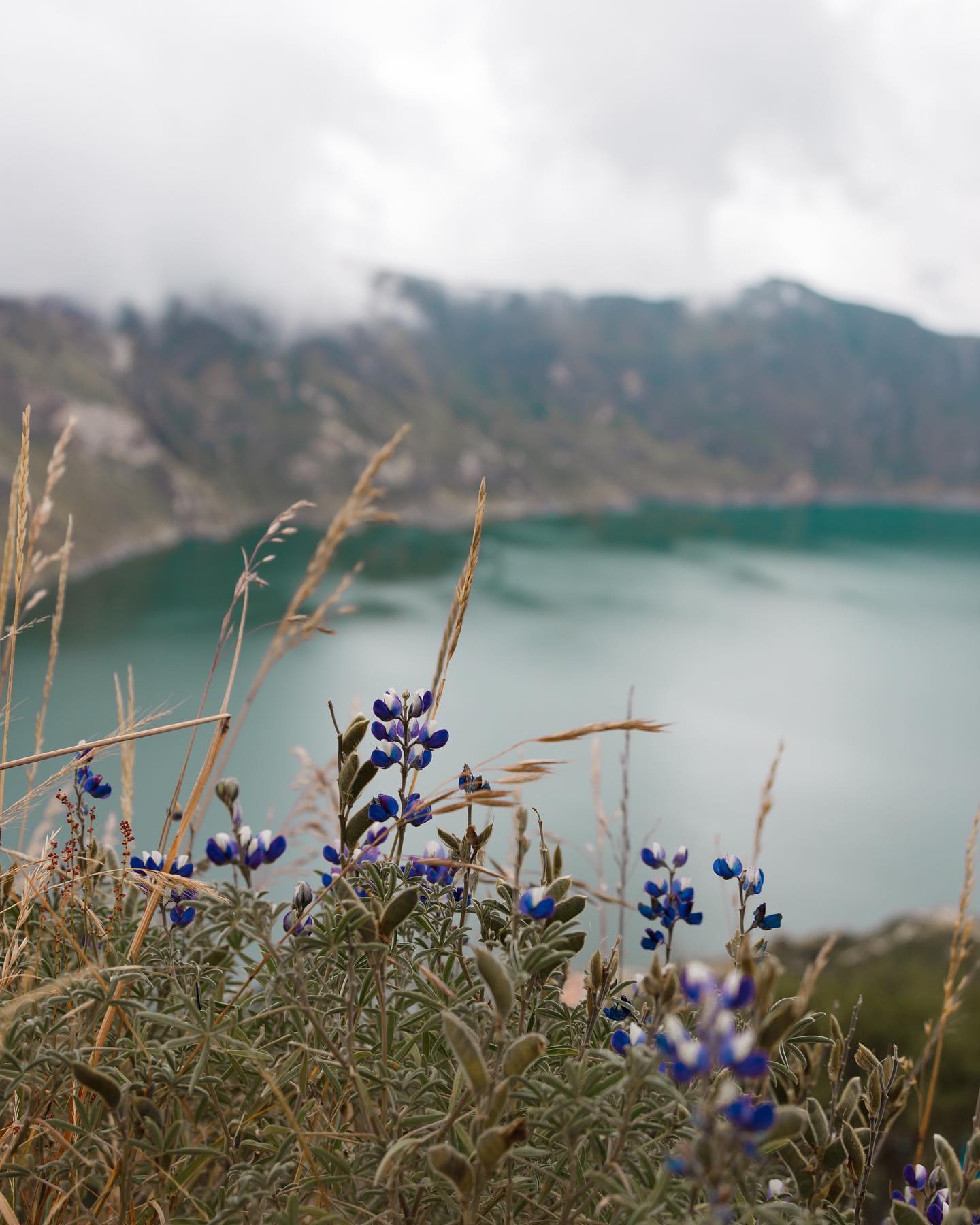
Vegetation clings to the upper ridges, dominated by tough páramo grasses adapted to the 3,914-meter elevation. The 10-kilometer trail circling the rim takes four to six hours to complete, offering constantly shifting angles of the water below. Drones and tripods are banned inside the reserve to protect nesting high-altitude bird species and prevent accidents along the narrow, unfenced paths. Pet dogs are also illegal within the Ilinizas Ecological Reserve, carrying strict penalties for owners who bring them past the village gates.
Indigenous Kichwa-speaking communities of Pujilí and Sigchos view the caldera as a sacred site. Local mythology identifies the deep water as the dwelling place of powerful mountain spirits. Community elders perform traditional rituals along the rim, leaving offerings to honor the gods of the lake and ensure safe harvests in the surrounding valleys. The physical landscape directly ties into their spiritual heritage, with the towering peaks acting as protectors of the villages below.
The lagoon dictates the daily economy of the Quilotoa hamlet. Residents manage all access to the crater, collecting a $2.00 fee at the village entrance to fund local infrastructure, parking lots, and public restrooms. Families operate small cafes, rent mules for the steep crater climb, and sell hand-carved wooden masks. Regional Andean dishes dominate the menus of the community-run restaurants near the trailhead, with roasted guinea pig serving as the primary specialty for visiting hikers.
Artistic traditions thrive in the neighboring Tigua community, located an hour away on the road to Latacunga. Painters use cured sheep hides as canvases to depict the bright green crater lake alongside scenes of Andean farming and condors in flight. Visitors stop at small roadside galleries to purchase these colorful crafts and observe traditional agricultural life. The artwork directly links the physical geography of the volcano to the cultural identity of the Cotopaxi Province.
Fourteen kilometers south of the crater, the Zumbahua Market operates every Saturday. This traditional gathering offers a raw look into the trading practices of the local indigenous population. Farmers trade regional agricultural products, vibrant textiles, and traditional Andean clothing. The multi-day Quilotoa Loop trek connects these cultural hubs, bringing backpackers through tiny mountain towns like Isinlivi and Chugchilán. Hikers stop in these villages to tour local cheese factories, visit wood carving workshops, and sleep in eco-sustainable lodges before completing their trek at the sacred crater lake.
Lahars from the 1280 eruption traveled 200 kilometers west until they crashed into the Pacific Ocean.
Swimming is banned due to freezing temperatures and high concentrations of volcanic minerals.
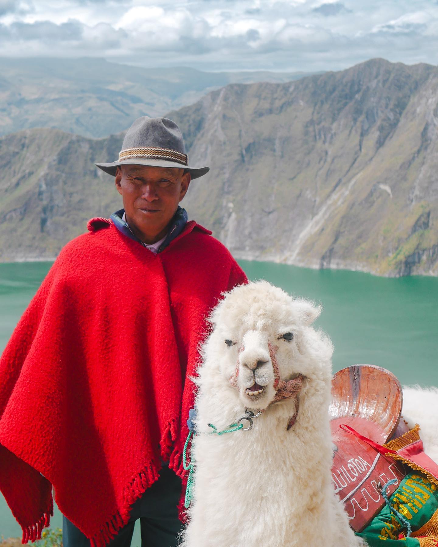
Local guides charge $10 to haul exhausted hikers up the 3,914-meter crater wall on mules.
Hot springs actively boil on the eastern shore of the freezing lake.
The lake shore sits 364 meters lower than the highest point on the crater rim.
Local artists paint landscapes of the lagoon exclusively on cured sheep hides.
The Shalalá lookout features a transparent floor suspended 3,900 meters above sea level.
A VEI-6 Plinian eruption in the year 1280 collapsed the volcano's dome. The resulting three-kilometer-wide caldera filled with rain and snowmelt over the next eight centuries.
The lake reaches a maximum depth of 250 meters. The crater floor drops off rapidly from the shoreline, hiding active fumaroles that vent volcanic gases.
High concentrations of dissolved volcanic minerals in the water scatter sunlight. Depending on the cloud cover and the angle of the sun, the surface shifts between dark emerald green and bright turquoise.
Swimming is strictly prohibited. The water contains unhealthy levels of volcanic minerals, the temperatures are freezing, and the sudden drop-offs make it highly dangerous.
Descending the 1.4-kilometer trail takes 30 to 45 minutes through loose volcanic sand. The return climb takes 45 to 90 minutes due to the steep grade and high altitude.
The village and the main viewpoints sit at 3,914 meters (12,841 feet) above sea level. Visitors often experience shortness of breath and altitude sickness at this height.
The volcano has not erupted since 1280, but it remains geologically active. Hot springs bubble on the eastern shore and sulfur gases vent from the lake floor.
The indigenous Kichwa-speaking community of Quilotoa manages the immediate area. They collect a $2.00 entry fee to maintain the village, parking lots, and restrooms.
The Quilotoa Loop is a multi-day trekking route through the remote Andean mountains. The 2-to-4-day hike connects small indigenous villages like Isinlivi and Chugchilán, ending at the crater lake.
The use of drones and tripods is banned within the protected area of the Reserva Ecológica Los Illinizas. Park rangers and local guides enforce this rule to protect wildlife and prevent accidents.
Browse verified tours with free cancellation and instant confirmation.
Find Tours